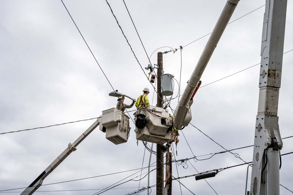
When Hurricane Beryl hit Texas in the summer of 2024, it resulted in widespread devastation to regional energy infrastructure. CenterPoint Energy, which provides electrical power to the Houston metro area and suffered two million customer outages, has since committed to investing as much as $2.7 billion through its Systemwide Resiliency Plan. These efforts include hardening overhead lines with stronger, storm-resilient poles and wires, expanding undergrounding in targeted areas, conducting enhanced vegetation management and other initiatives–all aimed at fortifying operations and proactively guarding against weather-related crises going forward.
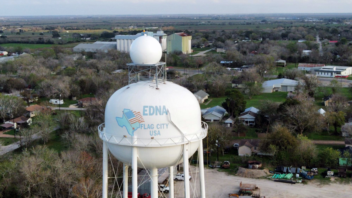
Climavision Radar in Edna, Texas
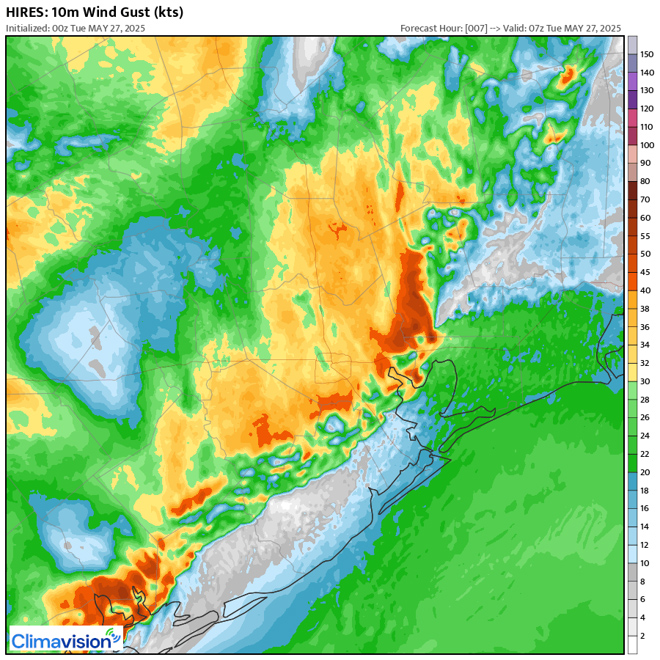
Climavision HI-RES model of Houston-Area Forecast from May 2025
CenterPoint Energy is far from alone. Over the last year, Tampa Electric in Florida, Entergy in Louisiana and LUMA Energy in Puerto Rico were also hit hard by hurricanes, resulting in widespread outages and other storm-induced damage.
While no energy provider is completely immune to the effects of extreme weather, such as hurricanes or otherwise, they’re able to drastically reduce impacts by getting ahead of these events. In the case of a hurricane, this requires more acute visibility into its progression, advanced knowledge of exactly when it will make landfall, where it will strike and hourly updates leading up to that point.
But it’s not just extreme weather that affects utilities. Every day, weather events can also have a disproportionate impact on energy production, demand, storage, alternative energy needs and pricing. These everyday shifts include events that likely don’t even hit the radar of the passive observer, such as summer heat that lasts a bit longer than anticipated, lower-than-average wind speeds, more or less precipitation than usual, unexpected cold snaps, high or low solar radiance and drought, to name a few.
When CenterPoint Energy set out to future-proof its electric infrastructure and operations after Hurricane Beryl made the decision not just to account for extreme weather but for every facet of weather that affects its ability to consistently deliver power to customers. Through its work with weather technology company Climavision, CenterPoint Energy has shifted its perspective on weather as an unpredictable risk factor to weather as a measurable operational asset. This approach makes it more resilient to extreme events and more efficient, sustainable, and reliable every day.
Here’s a look at how CenterPoint Energy’s far-reaching operational overhaul places weather at the forefront of its everyday decisions–and how other utilities can do the same.
1. Internal weather operations now reflect the importance of weather early warning impact on the organization.
It’s not unusual for utilities to have a meteorologist on staff, but weather has traditionally been siloed from the rest of the utilities’ operations. This means that while weather information is available, it’s not integrated. CenterPoint is now changing this.
CenterPoint has built out its weather operations to include two in-house meteorologists, a suite of publicly available tools and partnerships with private weather companies like Climavision to disseminate weather information across the company.
CenterPoint’s weather team is housed within its Emergency Preparedness and Response organization, although it monitors all weather events, not just extreme ones. When the team identifies a potential weather concern, it broadcasts it out via email and video to much of the organization, who escalates it further as needed.
2. Risk management plans now include more proactive measures in response to increasingly advanced weather visibility.
While energy grids across the U.S. remain vulnerable to severe weather, utilities are no longer totally helpless against it. Gone are the days when energy companies only had a handful of days or just hours to prepare for extreme weather events. They can now plan ahead to predict how damage to infrastructure will lead to outages and when and how to safely dispatch ground crews, among other precautions.
With advanced AI-enhanced weather modeling from Climavision CenterPoint Energy has visibility into specific weather formations and their progression into its region up to weeks in advance. This has enabled it to update its risk management plan to include key steps to be taken starting the moment it determines that a storm is approaching.
CenterPoint had the occasion to put this new capability into action this past October, before thunderstorms it had identified several days earlier knocked out power to nearly 200,000 customers. Using publicly available weather model data alone, CenterPoint’s meteorologists had only been able to identify “chances of strong to severe thunderstorms.” Using Climavision’s HI-RES model suite, however, it was able to forecast the risk of 50 to 70 mph wind gusts in the Houston area.
Equipped with this information, the team likened the risk to a similar event in May that had knocked out power to over 150,000 customers. CenterPoint got to work, convening internal calls and meetings to prepare for an Emergency Operations Center (EOC) activation and disaster response. The team was pre-positioned, staffed up and ready to respond to the storm. While there was nothing it could do to prevent outages altogether, its goal was to have almost all customers restored within 24 hours. And it was able to achieve exactly this, thanks to the advanced planning and the enhanced weather visibility afforded it.
3. From extreme weather to big-picture seasonal shifts, any weather event that influences energy production and operations is officially “on the radar.”
It’s not enough for utilities to look only at last year’s data to roughly predict what will happen this year. Instead, they should look at subtle shifts in regional weather, month to month and quarter to quarter, to predict the seemingly small nuances that can have a disproportional influence on energy output, demand and pricing.
For instance, if the season stays warm for even a few days longer than average, energy companies must be prepared to continue powering cooling for up to millions of people until temperatures lower when they might otherwise be gearing up for heating.
It’s also important to understand basic heat trends, considering that heat directly affects renewable performance: while solar output often improves, wind and hydro resources often underdeliver. And when heat sticks around, cooling is also delayed, which has an outsized impact on gas markets.
Similarly, precipitation levels directly influence hydropower. For regions that rely on it, lower levels of rainfall could leave them with less hydropower than they need.
And in states like Texas, where wind power is essential to supplementing traditional energy sources, even minuscule decreases in wind speeds are guaranteed to be felt for weeks. One metric that CenterPoint’s meteorologists are paying increased attention to is potential thunderstorm wind speeds, which they can see at high resolution several days in advance of an event using Climavision’s HI-RES model. As occurred during the October event, CenterPoint meteorologists now use data from HI-RES to speak to decision-makers less in terms of explicit forecasts and more in terms of potential risks.
This enables CenterPoint to view potential outcomes at a resolution and granularity it cannot achieve using publicly available model guidance. CenterPoint’s region-specific knowledge and understanding of local Houston weather optimize its response, knowing that the conditions it’s preparing for will occur directly in its service area, rather than surrounding ones.
4. Hyper-local weather data gives utilities the street-level visibility they need during extreme weather events.
Knowing that a storm will hit their overall region gives utilities information they need to take big-picture precautions, but CenterPoint Energy now goes far more granular than generalized regional data. Instead, it uses operational forecasts that reflect moment-by-moment conditions happening in its direct grid footprint.
To do this, CenterPoint Energy uses every data point possible, including those from its own network of ground-based weather sensors across its service area, as well as those from Climavision’s hyper-local radar network, which gives it acute insight into what’s happening within 60 miles of each radar. Through Climavision’s proprietary radar network, CenterPoint is also able to capture weather events that were previously invisible using existing NEXRAD government-operated radars alone.
Together, these sources create a dynamic feedback loop: Data from CenterPoint’s sensors continuously feed Climavision’s models, while Climavision’s forecasts inform where CenterPoint should deploy additional sensors, creating a closed-loop system for real-time weather intelligence.
And all the while, CenterPoint receives direct, real-time measurements of temperature, wind, pressure and humidity conditions that are integrated directly into Climavision’s forecast models.
CenterPoint now has a continuous, hyper-local stream of weather intelligence that lets teams see severe convective activity forming between radar gaps (areas of land not covered by the existing government radar network), anticipate power restoration risks with greater precision and position crews based on forecasted storm severity at the neighborhood level. Climavision’s additional radar coverage importantly allows CenterPoint to keep its crews safe in the event of a prolonged storm response effort.
These hyper-local observations aren’t just valuable in a crisis; they’ve become foundational to day-to-day grid optimization, helping CenterPoint refine load forecasting, renewable generation planning and maintenance scheduling around subtle but significant weather shifts.
With this level of advanced insight into which neighborhoods are most likely to be affected, utilities can prevent–or at least, offset–scenarios such as poles going down, transformers and crossarms being damaged and electricity wires being strewn across roads and public areas.
To consistently deliver power to customers, even in extreme circumstances, utilities must ensure the predictability and adaptability of their operations and infrastructure. For most utilities across the US–and the world–this requires a fundamental transformation.
Working with Climavision, CenterPoint Energy has created a path forward for itself and others who are exploring a similar transformation that reflects the realities of the weather’s impact on their operations and infrastructure.

Chris Goode is the founder and CEO of Climavision, where he leads the only comprehensive supplemental radar network in the United States and a suite of high-resolution forecasting technologies. With more than 30 years of weather industry experience, he has guided the company’s rapid expansion since its 2021 launch, with backing from TPG’s The Rise Fund. An Air Force Weather veteran and former executive at The Weather Channel Companies, AirDat and Enterprise Electronics Corporation, Goode brings deep operational expertise to advancing real-time weather intelligence for grid resilience, energy trading and other weather-sensitive sectors.
Matt Lanza joined CenterPoint Energy in 2024 as the meteorology manager. He leads the company’s internal weather intelligence efforts for daily, short-term and long-term weather planning. Lanza has been working to transform how weather data and analytics are integrated into CNP’s outage planning to prepare for, respond to and mitigate against the impacts of hurricanes, tropical storms, winter weather, wildfires and other extreme weather events that may impact any parts of our service territory. Lanza brings over 20 years of experience in meteorology and leadership. His background includes meteorology broadcasting, natural gas trading and load forecasting. He earned a bachelor’s degree in meteorology from Rutgers University and is a Certified Digital Meteorologist with the American Meteorological Society.