
The advent of GPS positioning technology has resulted in the general availability of high quality positioning technology at relatively low prices. Additionally the introduction of easy to use instruments means that positioning tasks may be undertaken in the field by personnel with limited professional knowledge of survey techniques.
The only disadvantage inherent in these developments is that users are faced with a wide array of options regarding equipment, methods, performance and prices. Making the wrong choices can result in work not being performed to specification or investment exceeding that which is necessary.
This article addresses some of the factors to be considered when evaluating GPS options, namely: accuracy, method, ease of use, price.
1. Accuracy
GPS is used to determine location. The accuracy of this determination depends on the type and quality of equipment used and the circumstances at the time of data collection. While it is important that the final data quality should be within specification, it is also important to ensure that no more cost and effort is expended than necessary to meet the specifications reliably.
There are varied definitions of accuracy, these include: ‘Average’ - not very useful unless the user intends to take a large number of readings on location; ‘SEP’ and ‘CEP’ (Spherical and Circular Error Probable) - the radius of a sphere and circle respectively within which 50% of readings are expected to fall; and statistical models based on combined linear errors such as ‘drms’ (~ 65% of readings) and ‘2drms’ (~ 95% - 98% of readings). When analyzing accuracy claims it is important to be aware of these differences. Those that incorporate the largest amount of data points (2drms or 95% level results) reduce the risk of the user experiencing unexpectedly large errors in the field. ‘Average’ and CEP readings are less useful with regard to estimating worse case conditions.
Real time horizontal accuracy at the 95% level varies from ~ +/- 10 meters with a low cost uncorrected single frequency receiver, through < +/- 1 meter with a good quality single frequency receiver using good quality differential corrections, to sub centimeter with a carefully deployed dual frequency RTK set-up using a local reference point. The price of equipment ranges from a hundred dollars or so through several thousand dollars to over fifty thousand dollars as you move through these options.
Accuracy on the vertical axis is normally ~ 2 to 3 times less good than on each horizontal axis due to the satellites required for good vertical measurements being shadowed by the earth.
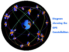
Local conditions can also effect accuracy. Signal blockage from trees and buildings will reduce the positioning information available. Multi-path effects, where GPS signal reflections result in erroneous range measurements, degrade the quality of the fix, and the continuously changing satellite geometry means that at times the geometry of the satellites is less than ideal. Generally speaking, now that the full constellation of GPS satellites is deployed, satellite geometry only becomes an issue when operating at the very highest levels of GPS accuracy.
2. Method
GPS data collection and processing may be broken down, very broadly, into two categories – position information may be derived in real-time or through post-processing.
The advantages of real-time positioning are: the increased likelihood of errors being detected in a timely fashion, the reduction of man-hours required to post-process data, and the ability to ‘navigate’ while undertaking the work.
The most basic real-time operations can be undertaken using uncorrected GPS. Accuracy is likely to be in the +/- 8 – 12 meter range depending on the quality of GPS receiver. There is little advantage to using a high quality GPS receiver for these kinds of operations.
For greater accuracy a differential correction is required. These may be obtained by using a dedicated reference station and radio link; government funded signals (the Coast Guard Beacon system or the satellite broadcast WAAS system), or commercially provided correction services.
Accuracy results range from ~ +/- 5 meters with a relatively low cost hand-held unit used in conjunction with the WAAS system, to sub meter results when a high grade instrument is used in conjunction with a dedicated reference station or satellite broadcast commercial corrections.
Very high levels of real time accuracy (potentially sub-centimeter) can be achieved using dual frequency receivers (one as a local reference) and a high speed data link. This technique, known as Real Time Kinematic (RTK) is relatively expensive and, due to the potential for error, requires knowledgeable operators.
Most recently, a new wide-area high accuracy service, which fills the gap between sub-meter L1 DGPS and sub-centimeter RTK, has been introduced. This less expensive and relatively easy to use method is uniquely achieving real-time accuracies of better than +/- 15cms at the 95% level without the need for a local base station or radio data link.
Post processing can provide higher levels of accuracy for less capital investment in equipment and is normally employed if longer occupation times are required when absolute maximum accuracy is the goal. Reference data may be collected simultaneously using a second receiver, or may be downloaded from publicly available sources such as the NGS CORS system or Community Base Stations.
3. Ease of Use
Not surprisingly, the more accuracy required, the more sophisticated the method that needs to be employed, and the more complex the operation becomes.
The use of uncorrected hand held devices is relatively straightforward. With the addition of real time correction data it becomes necessary to monitor the availability of the correction data and the fix quality to ensure results remain within specification. Loss of individual GPS satellite signal or differential correction data due to blockage may have an impact on the quality of the position.
One advantage resulting from the removal of SA in May of 2000 is that the rate of change of the remaining GPS errors is much slower and differential corrections remain valid for a much longer period than when SA was on. Loss of corrections for a few minutes should no longer be a problem provided sufficient GPS satellites remain in view.
Using a commercial differential correction supplier is less burdensome than operating a dedicated base station and, unlike the government correction services, technical assistance is available on demand to help with field operations. The new high accuracy services should also be of benefit for operations where the accuracy requirement cannot be met by ordinary submeter DGPS. Hitherto this has meant using dual frequency RTK methods, which are particularly challenging. The reference site must be properly positioned on an accurate survey point, the radio link should be such that there is an uninterrupted data stream, initialization and signal tracking must be monitored to avoid ‘cycle slips’, and range limitations apply.
Less hardware is required for post processing operations. However, savings in equipment costs need to be measured against any extra time required in the office for post processing. Also, although real time work requires the operator to keep a careful eye on things, field errors in post processing operations can be even more costly. If data is found to be below specification after collection it is costly, and may even be impossible, to deploy equipment for a repeat of the data collection phase.
4. Price
Price of equipment, and the costs associated with collecting and processing data, tend to increase directly in proportion to the quality of position data required.
The most basic handheld units are of the order of US$ 100 and can be taken into the field by a lone operator.
A complete RTK system may cost in excess of US$ 60,000 and requires much more sophisticated set-up and monitoring. However, it still allows for high accuracy data sets to be obtained more efficiently than with traditional survey methods.
Position information can be obtained with less equipment by using post processing techniques but there will probably be additional costs associated with the extra time required to manipulate the data.
The encouraging news is that, generally speaking, equipment costs are continuing to come down and the new GPS correction services are allowing for higher levels of accuracy to be achieved in real time at less cost and with less effort.
Summary.
GPS is an enormous benefit to any organisation requiring position information for mapping, asset positioning, etc. If accuracy requirements are stringent then it is not recommended to try to complete the work with insufficient investment in technology. Now that SA is no longer applied to the GPS signal moderate accuracy (~ +/- 8-10 meters) can be achieved with minimal investment. At the next stage, thanks to new services and developments in differential techniques, interim levels of accuracy (sub-meter and subdecimeter) are becoming achievable in real time without the need to go all the way to the most expensive RTK systems. However, these systems are still required for sub-centimeter work.
The only disadvantage inherent in these developments is that users are faced with a wide array of options regarding equipment, methods, performance and prices. Making the wrong choices can result in work not being performed to specification or investment exceeding that which is necessary.
This article addresses some of the factors to be considered when evaluating GPS options, namely: accuracy, method, ease of use, price.
1. Accuracy
GPS is used to determine location. The accuracy of this determination depends on the type and quality of equipment used and the circumstances at the time of data collection. While it is important that the final data quality should be within specification, it is also important to ensure that no more cost and effort is expended than necessary to meet the specifications reliably.
There are varied definitions of accuracy, these include: ‘Average’ - not very useful unless the user intends to take a large number of readings on location; ‘SEP’ and ‘CEP’ (Spherical and Circular Error Probable) - the radius of a sphere and circle respectively within which 50% of readings are expected to fall; and statistical models based on combined linear errors such as ‘drms’ (~ 65% of readings) and ‘2drms’ (~ 95% - 98% of readings). When analyzing accuracy claims it is important to be aware of these differences. Those that incorporate the largest amount of data points (2drms or 95% level results) reduce the risk of the user experiencing unexpectedly large errors in the field. ‘Average’ and CEP readings are less useful with regard to estimating worse case conditions.
Real time horizontal accuracy at the 95% level varies from ~ +/- 10 meters with a low cost uncorrected single frequency receiver, through < +/- 1 meter with a good quality single frequency receiver using good quality differential corrections, to sub centimeter with a carefully deployed dual frequency RTK set-up using a local reference point. The price of equipment ranges from a hundred dollars or so through several thousand dollars to over fifty thousand dollars as you move through these options.
Accuracy on the vertical axis is normally ~ 2 to 3 times less good than on each horizontal axis due to the satellites required for good vertical measurements being shadowed by the earth.
Local conditions can also effect accuracy. Signal blockage from trees and buildings will reduce the positioning information available. Multi-path effects, where GPS signal reflections result in erroneous range measurements, degrade the quality of the fix, and the continuously changing satellite geometry means that at times the geometry of the satellites is less than ideal. Generally speaking, now that the full constellation of GPS satellites is deployed, satellite geometry only becomes an issue when operating at the very highest levels of GPS accuracy.
2. Method
GPS data collection and processing may be broken down, very broadly, into two categories – position information may be derived in real-time or through post-processing.
The advantages of real-time positioning are: the increased likelihood of errors being detected in a timely fashion, the reduction of man-hours required to post-process data, and the ability to ‘navigate’ while undertaking the work.
The most basic real-time operations can be undertaken using uncorrected GPS. Accuracy is likely to be in the +/- 8 – 12 meter range depending on the quality of GPS receiver. There is little advantage to using a high quality GPS receiver for these kinds of operations.
For greater accuracy a differential correction is required. These may be obtained by using a dedicated reference station and radio link; government funded signals (the Coast Guard Beacon system or the satellite broadcast WAAS system), or commercially provided correction services.
Accuracy results range from ~ +/- 5 meters with a relatively low cost hand-held unit used in conjunction with the WAAS system, to sub meter results when a high grade instrument is used in conjunction with a dedicated reference station or satellite broadcast commercial corrections.
Very high levels of real time accuracy (potentially sub-centimeter) can be achieved using dual frequency receivers (one as a local reference) and a high speed data link. This technique, known as Real Time Kinematic (RTK) is relatively expensive and, due to the potential for error, requires knowledgeable operators.
Most recently, a new wide-area high accuracy service, which fills the gap between sub-meter L1 DGPS and sub-centimeter RTK, has been introduced. This less expensive and relatively easy to use method is uniquely achieving real-time accuracies of better than +/- 15cms at the 95% level without the need for a local base station or radio data link.
Post processing can provide higher levels of accuracy for less capital investment in equipment and is normally employed if longer occupation times are required when absolute maximum accuracy is the goal. Reference data may be collected simultaneously using a second receiver, or may be downloaded from publicly available sources such as the NGS CORS system or Community Base Stations.
3. Ease of Use
Not surprisingly, the more accuracy required, the more sophisticated the method that needs to be employed, and the more complex the operation becomes.
The use of uncorrected hand held devices is relatively straightforward. With the addition of real time correction data it becomes necessary to monitor the availability of the correction data and the fix quality to ensure results remain within specification. Loss of individual GPS satellite signal or differential correction data due to blockage may have an impact on the quality of the position.
One advantage resulting from the removal of SA in May of 2000 is that the rate of change of the remaining GPS errors is much slower and differential corrections remain valid for a much longer period than when SA was on. Loss of corrections for a few minutes should no longer be a problem provided sufficient GPS satellites remain in view.
Using a commercial differential correction supplier is less burdensome than operating a dedicated base station and, unlike the government correction services, technical assistance is available on demand to help with field operations. The new high accuracy services should also be of benefit for operations where the accuracy requirement cannot be met by ordinary submeter DGPS. Hitherto this has meant using dual frequency RTK methods, which are particularly challenging. The reference site must be properly positioned on an accurate survey point, the radio link should be such that there is an uninterrupted data stream, initialization and signal tracking must be monitored to avoid ‘cycle slips’, and range limitations apply.
Less hardware is required for post processing operations. However, savings in equipment costs need to be measured against any extra time required in the office for post processing. Also, although real time work requires the operator to keep a careful eye on things, field errors in post processing operations can be even more costly. If data is found to be below specification after collection it is costly, and may even be impossible, to deploy equipment for a repeat of the data collection phase.
4. Price
Price of equipment, and the costs associated with collecting and processing data, tend to increase directly in proportion to the quality of position data required.
The most basic handheld units are of the order of US$ 100 and can be taken into the field by a lone operator.
A complete RTK system may cost in excess of US$ 60,000 and requires much more sophisticated set-up and monitoring. However, it still allows for high accuracy data sets to be obtained more efficiently than with traditional survey methods.
Position information can be obtained with less equipment by using post processing techniques but there will probably be additional costs associated with the extra time required to manipulate the data.
The encouraging news is that, generally speaking, equipment costs are continuing to come down and the new GPS correction services are allowing for higher levels of accuracy to be achieved in real time at less cost and with less effort.
Summary.
GPS is an enormous benefit to any organisation requiring position information for mapping, asset positioning, etc. If accuracy requirements are stringent then it is not recommended to try to complete the work with insufficient investment in technology. Now that SA is no longer applied to the GPS signal moderate accuracy (~ +/- 8-10 meters) can be achieved with minimal investment. At the next stage, thanks to new services and developments in differential techniques, interim levels of accuracy (sub-meter and subdecimeter) are becoming achievable in real time without the need to go all the way to the most expensive RTK systems. However, these systems are still required for sub-centimeter work.