
Customer satisfaction is the name of the game. As consumers, we expect to flip a switch and have the lights turn on. But this simple action requires a chain-reaction of complicated processes. A utility’s administrative, engineering and operational personnel must have access to the right information at key intervals to make sure service is uninterrupted. Whether planning, designing or operating the network – or engaging in any number of key business tasks -- the network model is the foundation and source for spatially-enabled information.
Unfortunately, access to this crucial data is often limited. A current, growing challenge for utilities is to provide secure, real-time access among multiple users to location-based engineering and operational data across the utility enterprise. The challenge is not surprising. Data, systems and processes often are managed independently, without regard for future needs or integration. Such disconnects prevent a wide range of network users from seeing what is occurring with utility operations and assets. They also create inefficiencies, redundant processes and even raise questions regarding the accuracy of data. Fragmentation of the information needed for effective decision making in the field or in the office can weaken the utility’s ability to deliver quality service, especially when crises occur within power service areas.
Wider Access to Real-Time Data Needed
To counter these complexities, utilities are realizing the need to implement processes that can provide necessary data to employees and other key users anytime, anywhere, and in multiple ways – for example, by leveraging consumer mobile devices and platforms. In short, the utility must be in control of every aspect of its network data so that decisions can be made in an all-inclusive manner. After all, effective data management involves collecting, storing, organizing, analyzing and sharing information comprehensively. Furthermore, this means utility users must be empowered to do the work they need to do, as easily as possible – with task-specific applications, as opposed to general mobile GIS or mapping applications.
The most effective way to enable information to reach those utility users who need it most is through a web service-enabled network model. Based on standard, open protocols, a web service is a means of sharing data to applications via the Internet or corporate intranet. Such a solution pushes feature-rich data out in real time so that the utility can manage any number of incidents or day-to-day tasks more expediently. Any client application, from any vendor, can utilize these web services for a variety of workflows.
The right software should permit GIS administrators to easily and rapidly set up a web service featuring the network data and symbology managed in their enterprise utility GIS. Using portal and mobile applications, users should be able to browse, visualize, analyze, update and add network feature information from the web and consumer mobile devices.
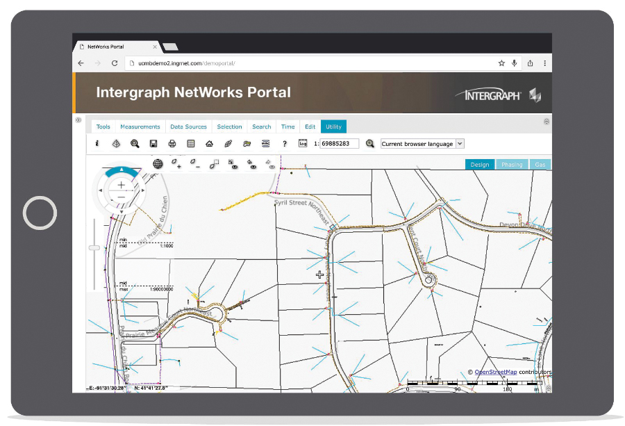
Networks portal screen shot
(click to enlarge)
Merge, Combine Data From Other Systems
Not only can users share network data, they also can merge and combine it with information from other systems and applications necessary for the task at hand. Let’s say a storm has rolled into an area and unleashed considerable damage – a typical scenario routinely confronting a utility. The utility’s field personnel can easily assess the damage with mobile devices by taking photos and making edits and notes about aspects of the damage they’ve seen in the field. Using a web services-based solution extended to portals and mobile apps, the source network information is available to crews and information from the field is immediately accessible by all necessary personnel, which yields smoother workflows, cost savings and efficiency.
“Every utility has someone who does the map request,” according to Michael Baker, product manager for Hexagon Safety & Infrastructure’s utility GIS products, Intergraph G/Technology and Intergraph NetWorks. “The isolation of data isn’t intentional; it’s just that in this day and age, everyone uses the tools that he or she is familiar with. The person handling the data requests usually is converting data from one format into another. With an open-data web service, it’s independent of any client, which means that now this person who was handling data requests is freed up for other tasks.”
Plus, those outside of the GIS department get the information they need how and when they need it. So, for instance, if a switch has been closed or is open, Baker added, this will be reflected in the data from the network. Keep in mind that with an enterprise data network, information is not going to be pushed out to everyone in its entirety. Instead, accessibility will be permission-based so that the utility can provide only information it wants to share with its many users.
Growing Consumer Demand
The move toward web-provided data to all stakeholders is not new, but it has gained momentum and become more refined (that is, to serve very specific purposes) due to growing demand by the utility’s customers. These customers already have come to expect more information in their daily lives, and quickly, from all kinds of devices, including phones, tablets and websites. Naturally, with a craving for everything mobile and cloud-based, consumers have now pushed on utilities to provide more information and to make it easier to retrieve. “It’s almost kind of like the perfect storm where everything is available to utilities to bring all of their data together and push it out to everyone who needs it – but in the very specific way they need it, which is different for customers versus field crews,” Baker said. “With the evolution of the enterprise data network, now this is the way to share data.”
Utilities Pushed To Lower Costs
In addition to the consumer push for more information, there also is pressure on utilities to lower their costs. Web services-enabled network information can dramatically help meet this demand. A web portal being fed from the network model makes it easy and less expensive to access and manipulate data. All the client needs is a browser, and that browser can be on any smart device. The portal is the only software the user needs. “So, suddenly the cost of installing a client on everybody’s machine to view data goes down,” Baker noted. This can apply to a utility crew working in the field, a contractor, or a temporary worker. “Instead of needing an application installed on their machine, they can just access the data through the browser,” Baker added. “This reduction of software costs and of the need for having installs will be significant.”
One Public Utility Sees Big Gains with Real-Time Data Network
Benjamin Beberness, Chief Information Officer for Snohomish County Public Utility District (PUD), north of Seattle, would agree with the benefits offered by creating real-time operations in its transmission and distribution systems, and on the PUD’s business side, too. Snohomish County PUD supplies electricity to 337,000 customers and water to nearly 20,000 customers in a major part of northwestern Washington State. In addition to upgrading its electric grid with a ‘smart’ grid system, automating substations and distribution systems, it has consolidated its IT resources onto a single real-time enterprise platform. “We had three ERP (enterprise resource planning) systems when we were considering a platform solution,” Beberness said. “They were all disconnected, and we had to enter the same information in multiple systems.”

Engineer with mobile tablet
Now, with the real-time enterprise data network in place, which leverages SAP integrated with Hexagon Safety & Infrastructure’s utility GIS, Snohomish PUD is more efficient, saving time and money, and giving key users the information they need regardless of time or location. “Let’s say I’m an assessor in the field responding to damage caused by a storm,” Beberness offered in describing the network’s value. “I’ve just walked up and down this line of damaged area. As I’m updating that and feeding the information via tablets back to our outage management system, customer service system and work management system, our office is scheduling crews and determining which crews have the right equipment and skills to be able to fix the damage,” Beberness continued. “Crews are all connected and can respond in real time. They can indicate they’ve just finished one job and can ask what needs to be done next and what crews are available and when.”
The network data is helpful not just for storm assessment, but also for normal maintenance work that utilities must perform.
Spatial Component Also Valuable
A truly robust enterprise solution should not just let you view data and edit it, but should also have a spatial component. Think about a tornado that touches down and runs for a mile and a half. Using the network data, the user can send a polygon with all the features contained in the polygon, such as poles, conductors or anything else. This means they can send information to the server and request not just attributes but also spatially where they are. Not only would the network offer a map of the data, and allow the user to edit attributes of the data, but that user could also request an area of interest and extract this from the network. This might be the foundational step for a crew to conclude that it needs, for example, 50 poles because there are this many poles within the polygon that are damaged.
Since the data network is web-driven, “It’s easy to combine it or integrate it with other data, such as data that might be coming back from SCADA (supervisory control and data acquisition) or DMS (distribution management system),” noted Baker, citing automated meters or the operating temperature of a transformer as examples. “What’s nice about this web service is that you can combine it with those other systems to get a visual of what’s going on. It’s a really great way to give a visual representation of what’s occurring on the network,” Baker said.
Compelling Advantages
Deploying a web services-based network solution for a utility enterprise offers several distinct advantages, including:
- Replacement of fragmented, siloed information and systems with an integrated, reusable connection that distributes data throughout the enterprise.
- More accurate data for enterprise users and customers. The currency of data improves because users access a definitive source to which they can, in turn, provide data more quickly and easily and view others’ updates.
- Vastly improved operations for employees. The GIS manager will spend less time processing data requests, and see better data quality. Customer service representatives will deliver improved customer satisfaction because they’re able to view real, up-to-date data. The IT manager will have lower costs of dealing with information, and have better agility and improved control over data.
- Lowered duration of customer power outages as a result of improved response time, reducing labor and overtime costs.
As web services-driven applications come online, they will reflect data from everything users have stored inside their database. Consequently, this will increase the value of a utility’s data by extending its visibility and reducing costs because the data already has been configured.
Potential for More Innovation
These advancements underscore the power of extending the network model via web services to task-specific applications across a utility enterprise. What’s more, they show how such a comprehensive capability will enable users to be more innovative with the services they provide. How? Beberness, the Snohomish County PUD Chief Information Officer, cites a dramatic example. According to Beberness, one utility on the East Coast can predict exactly where their power outages will be before they actually happen because the utility’s operators can view weather patterns and combine this information with the network’s database of information on prior outages. “If you have a big wind storm coming through and you know pretty well where you think the high gusts of those winds will be, the utility can look at what equipment is in that area,” Beberness said. “So, you stage your crews based on the damage you assume is going to happen. I think utilities have to think along these lines and about how they can become more efficient and effective,” Beberness added. “We can be better prepared and improve our outage numbers, which will lead to better customer service and reliability.”
About the Author
 Bob Galvin is a freelance writer based in Oregon City, Oregon, who writes on issues and trends involving use of various business technologies. He can be reached at: rsgpr@msn.com.